


Gap of Dunloe

Lobin
User
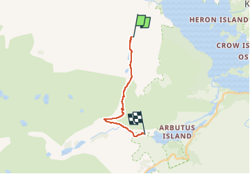

Length
11.1 km

Max alt
243 m

Uphill gradient
222 m
Km-Effort
14.2 km

Min alt
23 m

Downhill gradient
256 m
Boucle
No
Creation date :
2024-03-31 09:50:56.0
Updated on :
2024-03-31 15:25:46.812
2h26
Difficulty : Medium

FREE GPS app for hiking
 SityTrail
IGN / Geographical institutes
SityTrail Plus
The world is yours!
About
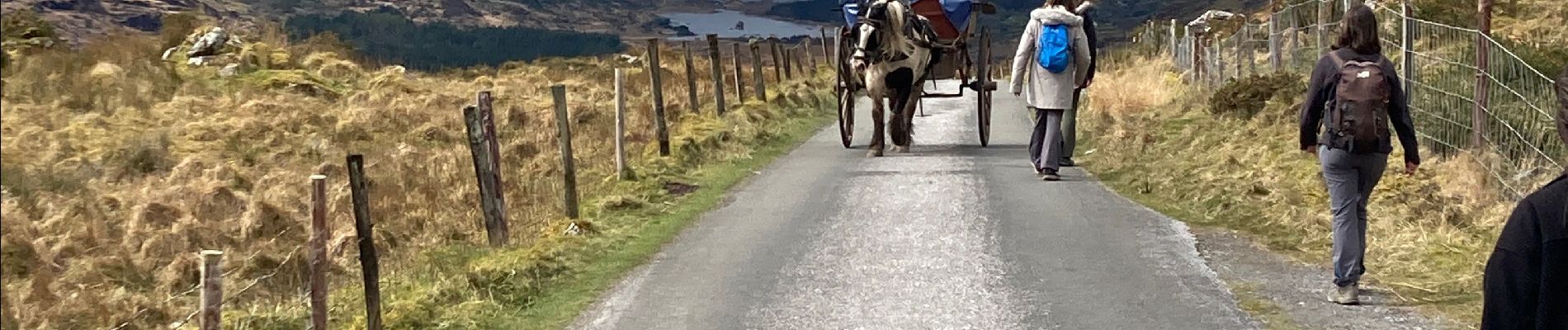
Trail Walking of 11.1 km to be discovered at Unknown, County Kerry, Kenmare Municipal District. This trail is proposed by Lobin.
Description
Il faut réserver la dépose en minibus au départ de la rando avec un Retour via les lacs.
Le chemin est une route mais ça vaut le coup. Le retour par les lacs est superbe
Photos


Positioning
Country:
Ireland
Region :
Unknown
Department/Province :
County Kerry
Municipality :
Kenmare Municipal District
Location:
Dunloe
Start:(Dec)
Start:(UTM)
456531 ; 5765573 (29U) N.
Comments